
Severe Thunderstorm Warning Issued
BULLETIN – IMMEDIATE BROADCAST REQUESTED
Severe Thunderstorm Warning
National Weather Service Greenville-Spartanburg SC
235 PM EDT Thu Oct 31 2019
The National Weather Service in Greenville-Spartanburg has issued a
* Severe Thunderstorm Warning for…
Eastern Franklin County in northeastern Georgia…
Northwestern Elbert County in northeastern Georgia…
Hart County in northeastern Georgia…
Northwestern Greenville County in Upstate South Carolina…
Anderson County in Upstate South Carolina…
Pickens County in Upstate South Carolina…
Eastern Oconee County in Upstate South Carolina…
* Until 315 PM EDT.
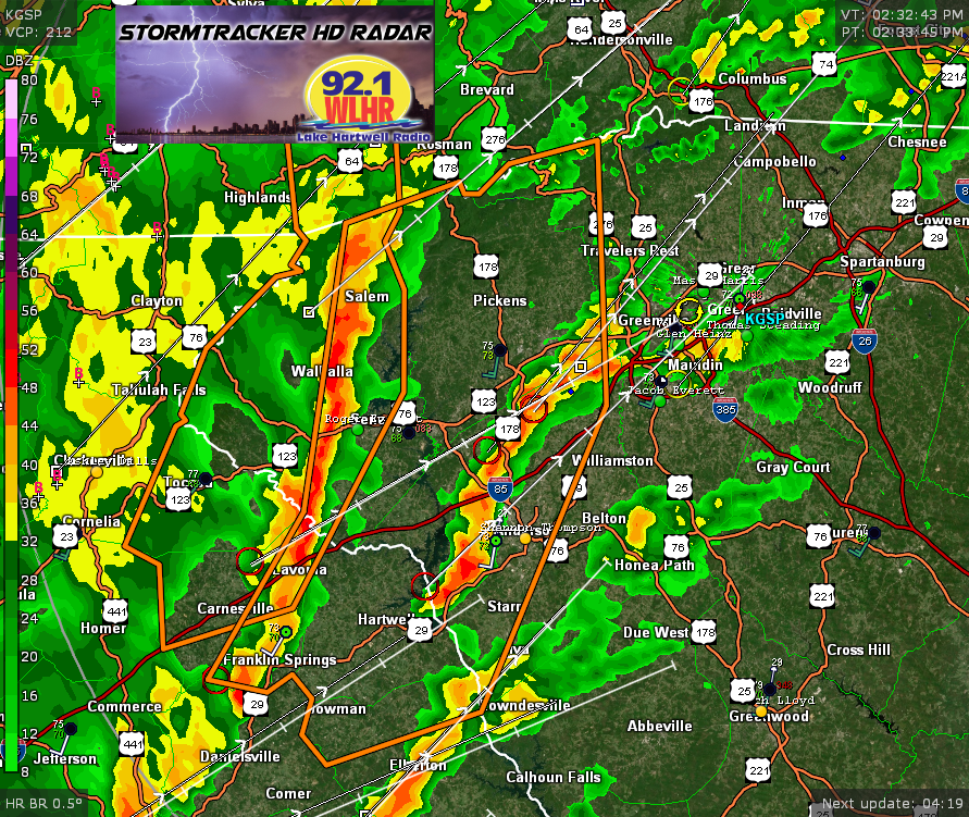
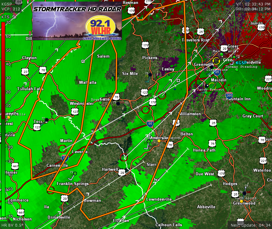
* At 234 PM EDT, severe thunderstorms were located along a line extending from 13 miles west of Pickens to 7 miles southwest of Seneca to 5 miles north of Danielsville, moving east at 45 mph.
HAZARD…60 mph wind gusts.
SOURCE…Radar indicated.
IMPACT…Expect damage to trees and power lines.
* Locations impacted include… Anderson, Easley, Clemson, Seneca, Hartwell, Pickens, Homeland Park, Central, Northlake and Pendleton.
PRECAUTIONARY/PREPAREDNESS ACTIONS…
Conditions are favorable for the development of brief, weak
tornadoes. Seek shelter inside an interior room.
Lake Jocassee, Lake Keowee, and Lake Hartwell are all in the path of these storms. Get away from the water and seek shelter in an interior room in the nearest shelter. If you can hear thunder, you are close enough to be struck by lightning.
Please report damaging winds, hail, or flooding to the National
Weather Service Greenville-Spartanburg by calling toll free, 1, 800, 2 6 7, 8 1 0 1, or by posting on our Facebook page, or Tweet it using hashtag nwsgsp. Your message should describe the event and the specific location where it occurred.